


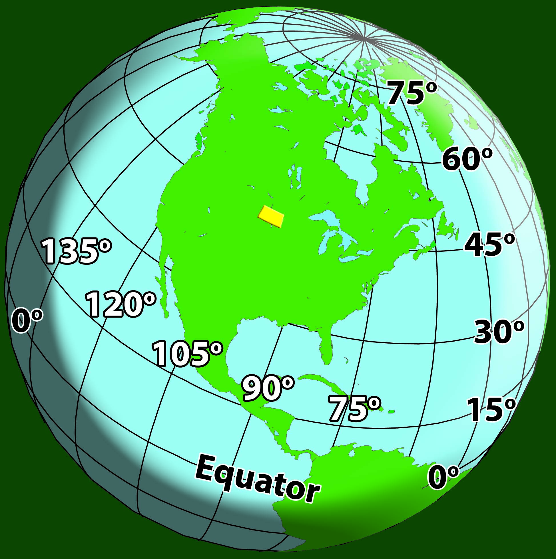
Figure 32. North Dakota is located at the center of the North American continent. Latitude is shown in black numbers. Longitude is shown in white numbers. (SHSND-ND Studies)
The continent of North AmericaContinent containing the countries of Canada, the United States, and Mexico contains the countries of Canada, the United States, and Mexico. North Dakota is located at the center of the continent. It is about 1,500 miles from North Dakota to any of the water that is around North America. The Atlantic Ocean (east), the Pacific Ocean (west), and the Gulf of Mexico (south) are all about 1,500 miles from North Dakota.
Fifty states make up the country of the United States. The total land area of North Dakota is 70,704 square miles. North Dakota ranks 18th in size (land area) among the states, which means 17 states are larger than North Dakota, and 32 are smaller. North Dakota is shaped almost like a rectangle. The length is about 360 miles from east to west, and the width is about 210 miles from north to south.
North Dakota is located along the Canadian border and touches two Canadian provinces (states). These provinces are Saskatchewan (sus-katch-a-wan) and Manitoba (man-a-toe-ba). North Dakota also touches Minnesota to the east, South Dakota to the south, and Montana to the west.