


Map-makers draw lines on maps so that it will be easier for people to understand locations. One way to describe North Dakota’s location in the world is by using the terms “latitude” and “longitude.” LatitudeThe distance north or south of the equator is the distance north or south of the equator, and longitudeThe distance east or west of the prime meridian is the distance east or west of a place in England called the prime meridian. The prime meridian is located at the Royal Observatory in Greenwich, England, near London. Latitude and longitude are measured in degrees. The symbol for degree is °. (In this context, “degree” is a measurement of distance and does not have anything to do with temperature.)
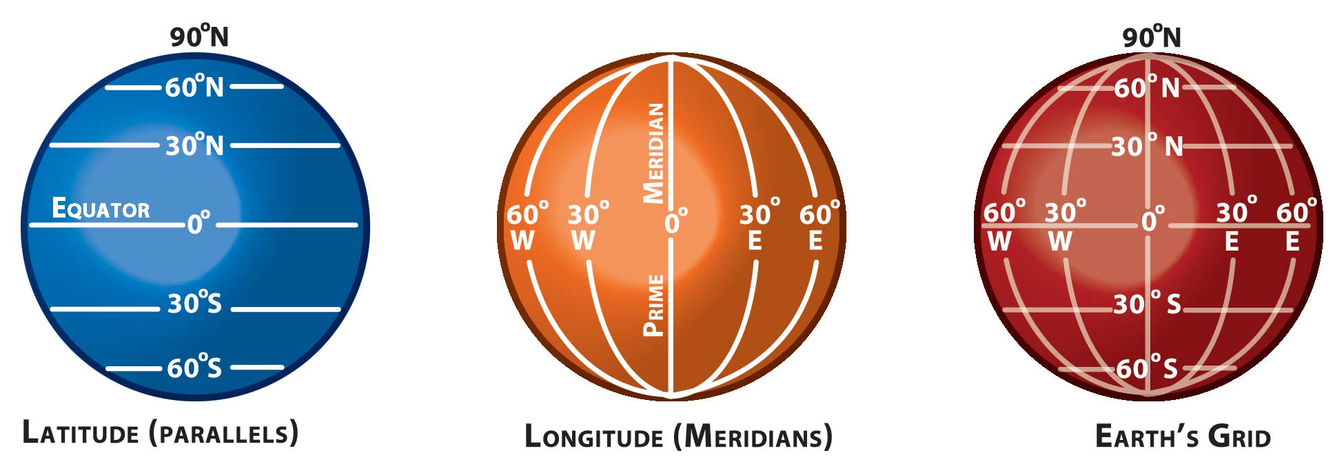
Figure 33. Earth’s grid. Latitude (parallels) run east and west. Longitude (meridians) run north and south. (SHSND-ND Studies)
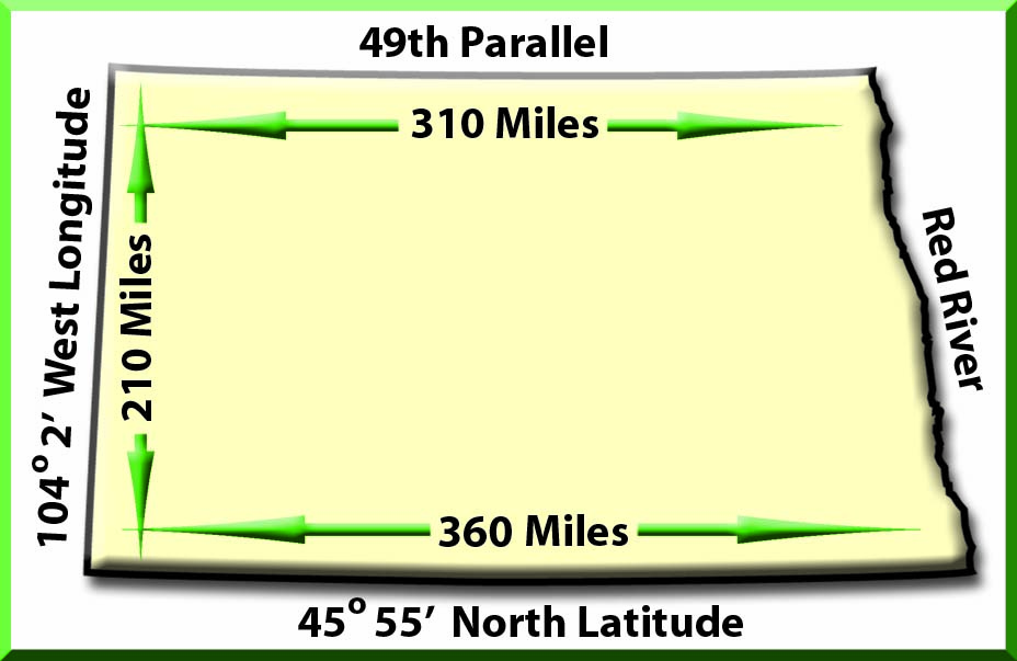
Figure 34. The area of North Dakota. (SHSND-ND Studies)
The equator is at zero degrees (0°) latitude. The North Pole is at 90° north latitude. The southern border of North Dakota is approximately 46° north latitude, and the northern border of North Dakota is at 49° north latitude. Because lines of latitude are also called “parallels,” we can say that North Dakota is located on the north 49th parallel.
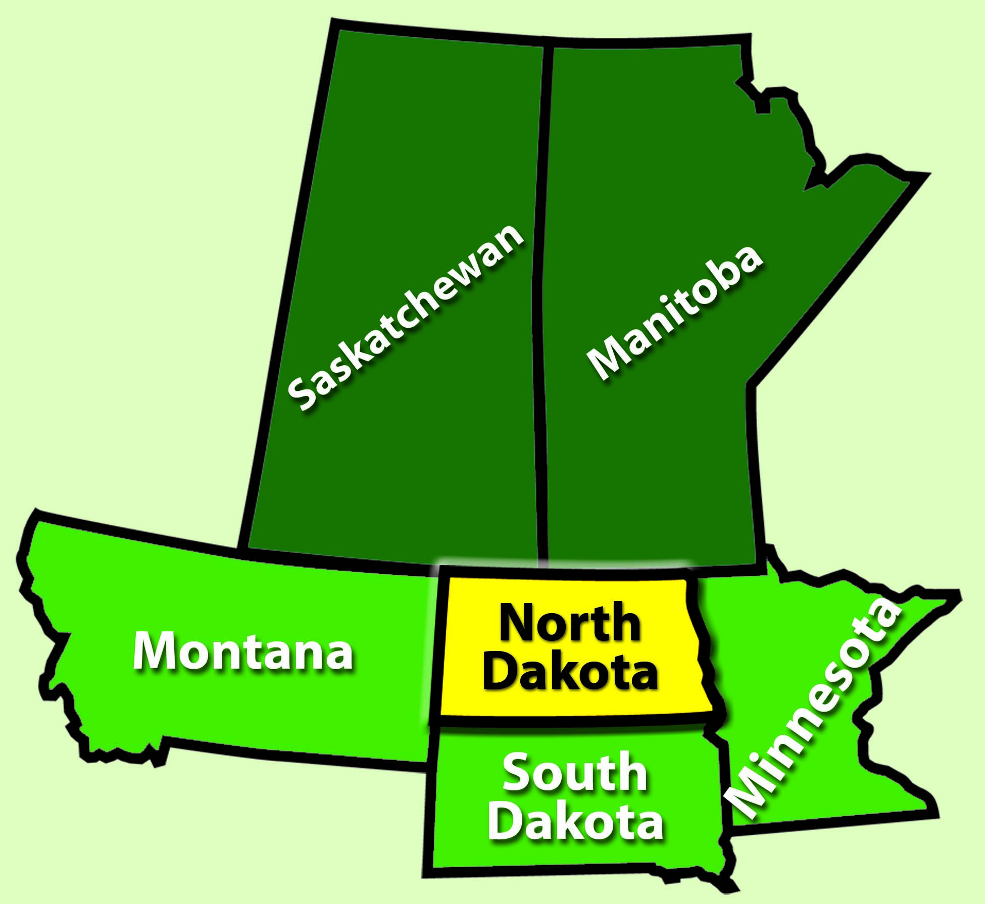
Figure 35. Minnesota, Montana, and South Dakota border North Dakota. The Canadian provinces of Saskatchewan and Manitoba border the state to the north. (SHSND-ND Studies)
The prime meridian in England is at zero degrees (0°) longitude. Lines of longitude are also called “meridians.” The continent of North America is west of England, so any longitudinal measurement on this continent is located on a meridian referred to as “west” longitude. The eastern border of North Dakota is about 97° west longitude, and the western border of the state is 104° west longitude. We can say that the western border is on the west 104th meridian.